This essay was written as a student project for HIST 7250: Practicum on the Place-Based Museum.
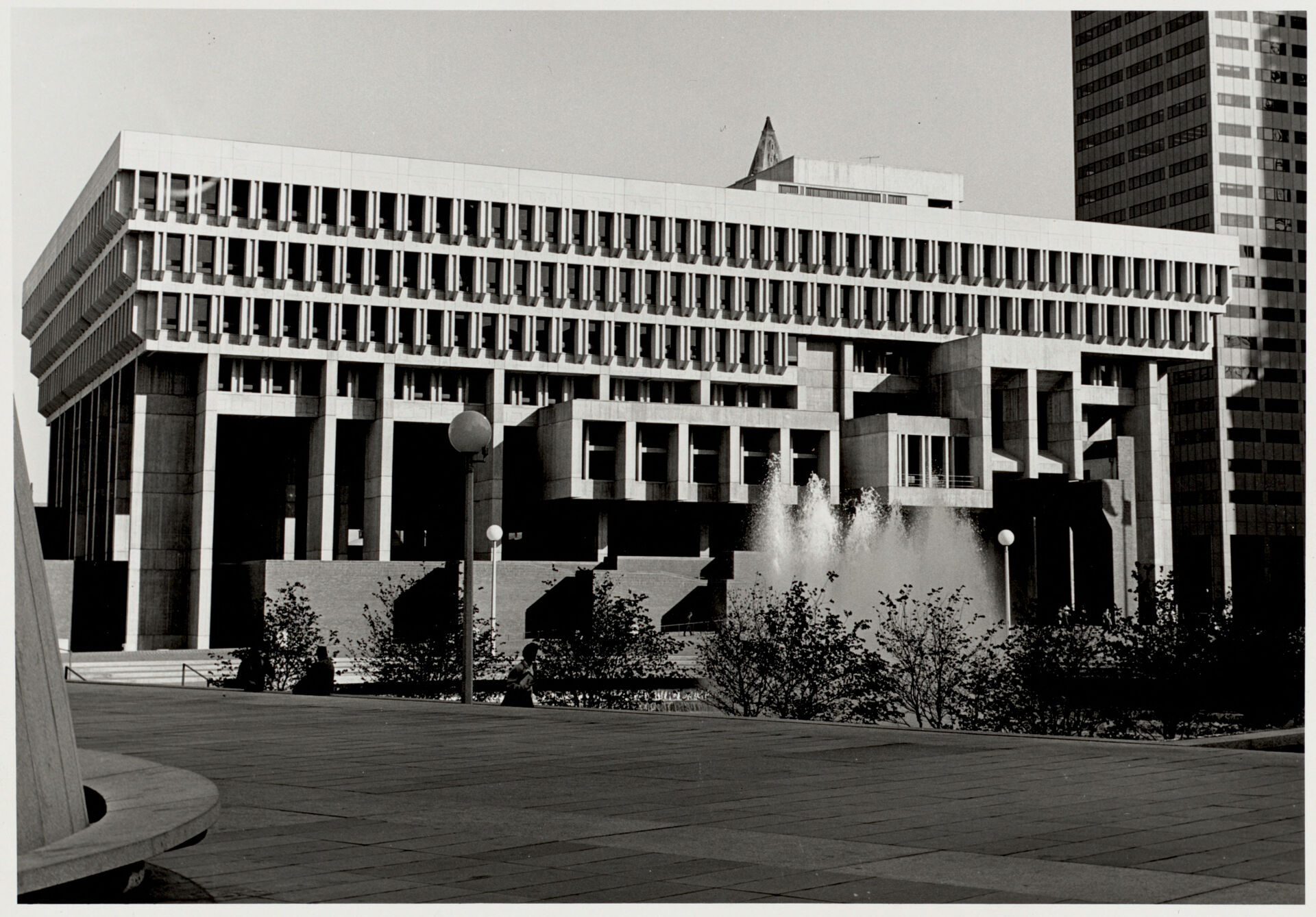
One of the most memorable features of Government Center is the 10-acre plaza located in front of City Hall. Previously a dense urban neighborhood, the large, empty space seems almost jarring. However, the creation of a large, empty space was deliberate. Early urban renewal plans for Government Center specifically set aside space for the purpose of allowing people to congregate. A 1958 report for the City Planning Board of Boston referred to the space set aside for the plaza as a “civic square,” and stated that one of the purposes of the redevelopment project was “to give Boston a new civic square, a new focus of community pride and activity.”
 The 1958 Report for the City Planning Board of Boston
City Hall Plaza was built specifically to be a place for civic activity, and protesting is just that, a civic activity. As a result, there is a direct link between Government Center and protests. Furthermore, this connection is explicitly stated today, as the City of Boston’s City Hall Plaza Events and Programs webpage, states that the plaza is a place for protest.
Anti-Busing Protests
Some of the most well-known protests to occur at Government Center are the busing protests of the 1970s. Beginning in 1974, Boston Public School students were bused from their neighborhood to a school located in a different neighborhood. This was an initiative undertaken in an effort to desegregate Boston’s public schools and provide more equitable educational opportunities to all of Boston’s children.
However, the busing initiative received major pushback, specifically from the parents of white children who felt the initiative was unfair. Anti-busing protests occurred throughout the city of Boston and continued for many years. However, two of the largest protests took place at Government Center.
On September 9, 1974, only a few days before Boston’s first day of school, a crowd of 10,000 protestors gathered in front of City Hall. After months of protests, this was the last opportunity for individuals against the busing initiative to stop busing before it was put into practice for the first time. As Senator Ted Kennedy attempted to placate the crowd and offer assurances on the benefits of busing, the protest took a hostile turn. The protestors attempted to attack the senator, who fled the scene. This protest did not prevent busing from occurring in the following days.
Two years later, on April 5, 1976, another anti-busing protest took place at Government Center. During this protest, Theodore Landsmark, an African American attorney, was attacked by white anti-busing protestors as he walked into City Hall. Depicted below is an image captured during the attack. Landsmark was attacked due to his status as an African American man, as racism played a significant role in the anti-busing protests.
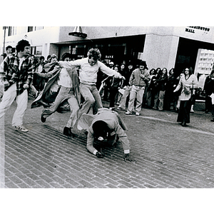 The attack on Theodore Landsmark, 1976
(Image courtesy of the Northeastern University Library’s Archives and Special Collections)
The attack on Theodore Landsmark, 1976
(Image courtesy of the Northeastern University Library’s Archives and Special Collections)
The anti-busing protests at Government Center did not stop busing from happening, however, they provided a location for individuals against busing to communicate their thoughts and feelings on the government initiative.
More Protests
Anti-busing protests were not the only protests that took place at Government Center. In fact, a wide range of topics have been protested at Government Center.
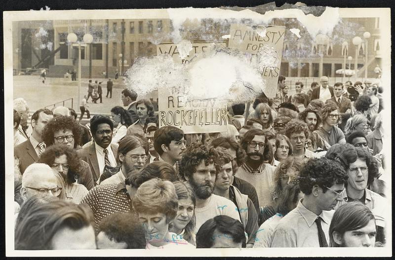
Numerous protests took place at Government Center in the 1970s in response to the government’s participation in the Vietnam War. Depicted in the picture below is the anti-war group, Vietnam Veterans Against the War, who held a demonstration at Government Center titled “Search and Destroy.” The demonstration involved the group dressing up as prisoners of war and carrying toy weapons. The group began their protest at the Boston Common but ended it at City Hall Plaza.
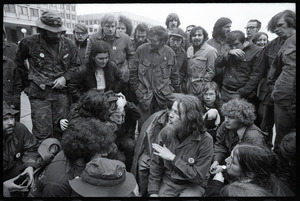 Vietnam Veterans Against the War, 1971
Teachers also held protests at Government Center, as evidenced by the 1969 protest for better working conditions. Depicted below are signs that were used in the protest. Thrown in a pile, the signs contain phrases such as “Support Better Schools” and “Teachers Need to Support Families.” The number of signs suggests that it was a large protest, however, only a few protestors surround the signs with City Hall visible in the background of the picture.
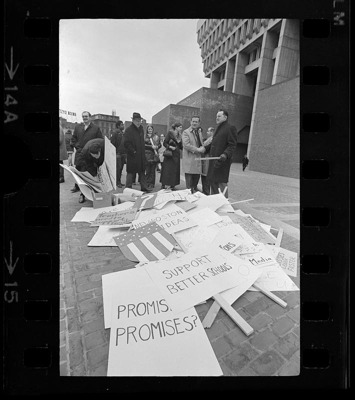 Teachers protest against working conditions, 1969
In the early 1970s, a protest calling for better conditions in Massachusetts jails and prisons took place at Government Center. This protest is said to have been prompted by a prison uprising that occurred in Attica, New York. Depicted below is the crowd that gathered to participate in the protest.
 Protest against Massachusetts jail and prison conditions, ca.1970-1972
These protests, while different in topic and approach, had the same goal, to communicate the beliefs of the community to the government in the hopes of change. Additionally, they chose the same location to try and achieve those goals, Government Center.
Protests Continue Today
Government Center continues to host protests today. On September 20, 2022, Extinction Rebellion Boston, an organization focused on climate change, led a protest bringing attention to the damaging long-term effects of climate change. Congregating outside of the Government Center MBTA stop, the group utilized flags and signs to bring attention to their message. On September 12, 2024, a group of pro-Palestine protesters, opposing the war in Gaza, visited Government Center on their walk through Boston.

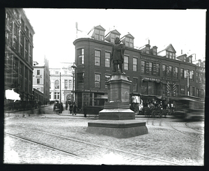
 Towards Beacon Hill